Apr 172013
 

Introduction :
The Manuel Antonio National Park is located near the city of Quepos in Puntarenas province of Costa Rica and is the smallest national park in Costa Rican. Despite its size, it has been listed as one of the world’s top 12 most beautiful national parks by Forbes business magazine for its beautiful beaches and hiking trails. The Manuel Antonio National Park us famed for its white sand beaches and lush foliage that reach the beaches and huge variety of wild life within a small area and is one of the most popular tourist destinations in Costa Rica.

Viewing the park from the hotel resort
Image attribution to dnevill @ Flickr

One of the landmarks of the Manuel Antonio National Park

Beautiful white sands beach at the national park
Image attribution to manueb @ Flickr

The Capuchin Monkey
The Capuchin Monkey
Image attribution to roaming-the-planet @ Flickr

History :
It was believed that Ponce de Leon, a Spanish explorer was the first to chart to Manuel Antonio into his nagivation map during the expedition search for the Fountain of Youth. The Manuel Antonio National Park is established in November 1972.

One of the unique flora species found in the park
Image attribution to manueb @ Flickr

Hoffman's Two Toed Sloth is one of the major features of the variety of wild life in the park
Hoffman’s Two Toed Sloth is one of the major features of the variety of wild life in the park

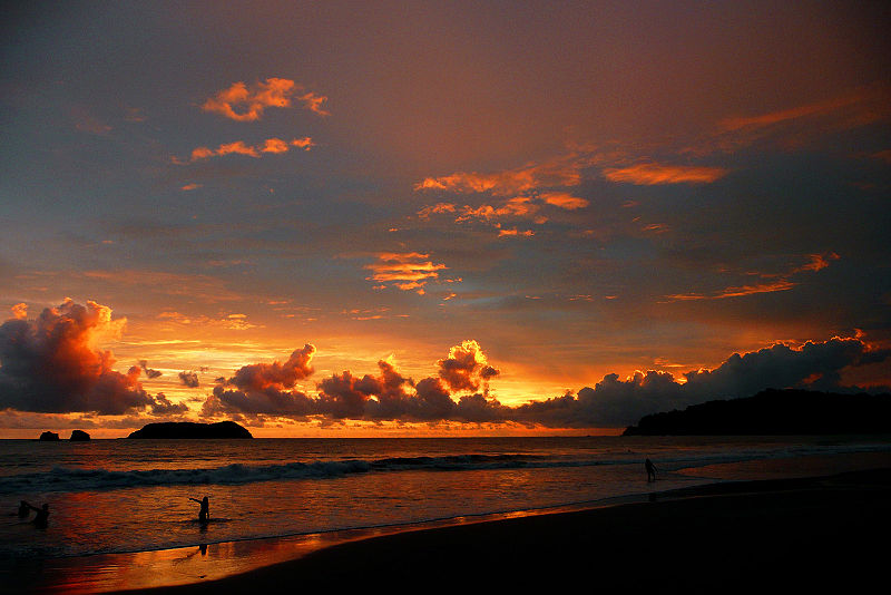
Sunset in the Manuel Antonio park

Getting there :
The nearest airport to the national park is the Quepos Managua Airport (XQP) which is just 8 km away from the attraction and is linked with Juan Santamaría International Airport (SJO) at San Jose which is around 132 km away. If you’re travelling by international one stop flights, you can go to the national park directly from the Juan Santamaría International Airport (SJO) by a shuttle bus that runs twice a day from San Jose.

Apr 162013
 

Introduction :
Meteora is a series of rock towers located just beside the city of Kalambaka in the Thessaly region of Greece. The main attractions in the Meteora is the monasteries built at the top of the rock towers and perched onto high cliffs which made it looked like hanging monasteries as the name Meteora was given. There are a total of 6 monastries built on top of the rock towers and those still intact today are the Holy Monastery of Great Meteoron, Varlaam, Rousanou, Nicolas Anapausas, St Stephen and Trinity. Due to its unique artistic values and amazing architectural properties, the Meteora was inscribed as a World Heritage Site in 1988 and is a world famous tourist attraction in Greece today.

Entrance to the Crac des Chevaliers
Holy Monastery of Varlaam was built to house to finger of St John and shoulder blade of St Andrew
Image attribution to Dido3 @ Wiki

Viewing the Meteora from a hotel at Kalambaka
Image attribution to mahnke @ Flickr

Steep cliffs and landscapes around the Meteora
Image attribution to davide78 @ Flickr

Holy Monastery of St Stephen
Image attribution to quicksilver @ Flickr

History :
THe earliest inhabitants in the region dates back to almost 50,000 years ago during the pre historic times. From the 9th century, a group of hermit monks moved up to the rock pillars at the Meteora and were the first people to settle in there. The great Meteoron monastery was built between 1356 and 1372 by Athanasios Koinovitis who brought a group of followers to the Meteora in 1344. Towards the end of the 14th century, more than 20 monasteries were built as an ideal refuge for the hermit monks seeking retreat from Turkish occupation. The Holy Monastery of Valaam was built in 1517 and was believed to house the finger of St John and shoulder blade of St Andrew. Despite having up to 24 monasteries at one time, bombings in World War II destroyed many sites and only 6 monasteries remain today with only four of them inhabited by less than 10 people each.

The landscape and surroundings looking down from the hanging monastery
Image attribution to fran001 @ Flickr

The Great Meteoron Monastery was the first to be built at the Meteora
Image attribution to Fingalo @ Wiki

The town of Kalambaka for residing tourists visiting the Meteora
Image attribution to Fingalo @ Wiki

Beautiful sunset at Meteora

Getting there :
The nearest airport to Meteora is the Nea Anchialos National Airport (VOL) which serves the city of Volos and is a 2 hours drive away from Kalambaka where the Meteora is just beside it. The nearest international airport is the Thessaloniki International Airport (SKG) which is 216 km from the Meteora and can be connected by buses, trains or renting a car and driving there yourself.

Apr 142013
 

Introduction :
Crac des Chevaliers is a medieval age crusader castle located near the city in Homs in the Homs governate of Syria. The crusader castle sits on top of a hill 650 metres tall east of Tartus on an important strategic route connecting the cities of Tripoli and Homs. The Crac des Chevaliers represents one of the best preserved examples of a crusader castle and features fortification influences from the Byzantine, Frankish and Ayyubid dynasties. Due to its historical importance, the castle was inscribed as a World Heritage Site by UNESCO in 2006.

Panorama of the crusader castle
Image attribution to Xvlun @ Wiki

Entrance to the Crac des Chevaliers
Image attribution to baltasarin @ Flickr

Outer walls used for sentry and defence of the castle
Image attribution to Mbenoist @ Wiki

Inner court at the top of the castle
Image attribution to Stijnnieuwendijk @ Flickr

History :
The site of the Crac des Cheavaliers was first occupied as a Kurdish settlement in 1030 AD as they often choose sites such a hills and mountains when building castles. During the Crusader Period, it was given by Raymond II in 1142 AD to the Knights Hospitaller and remain in their possession till 1271 AD. The Knights Hositallers began the rebuilding of the castle from 1140 to 1170 due to damage from an earthquake. in 1271, the castle was lost to the Baibars with a faked letter from the Crusdader Count of Tripoli ordering them to abandon the castle.

Surroundings and landscape around the Crac des Chevaliers
Image attribution to peuplier @ Flickr

Hall of the knights
Hall of the knights
Image attribution to Bgag @ Wiki

Eastern end inside the castle
Image attribution to Bgag @ Wiki

Getting there :
The nearest international airport to the Crac des Chevaliers is the Bassel Al-Assad International Airport that serves the city of Latakia and is around 78 km away from the crusader castle.
Due to an uprising that began in 2011, the attraction maybe be unsafe for travel. Please check with the related agencies to make sure it is safe for tourists before planning a trip to the Crac des Chevaliers